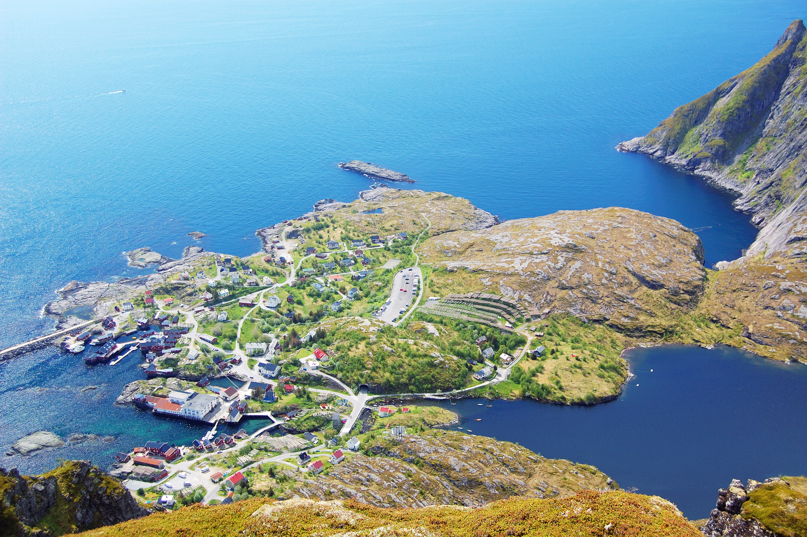
The E10 highway runs the length of the Lofoten archipelago. At Å, it just stops. The road ends in a parking lot, and beyond that parking lot, the Norwegian Sea stretches toward the horizon with the silhouette of Værøy island floating in the distance. Jagged peaks drop straight into the ocean on either side, and seabirds wheel overhead in the kind of silence you only notice because there's no traffic noise behind you anymore.
Most people treat this as a quick photo stop. They park, walk the short flat path to the ocean-facing cliffs, snap a picture at the end-of-road sign, and leave. That takes about 20 minutes.
Skip the cliff edge during midday. The main viewpoint becomes a bottleneck between roughly 10 AM and 4 PM in summer, packed with tour buses and campervans jockeying for space in the lot. Come before 9 AM instead. During June and July, the midnight sun means you can also show up at 10 or 11 PM and have the place nearly to yourself with soft golden light raking across the water.
From the cliffs, you're looking out toward the Moskstraumen, a system of tidal eddies and whirlpools between Moskenesøya and the island of Mosken. It's one of the strongest tidal currents in the world, notorious enough to have inspired Edgar Allan Poe and Jules Verne. On a rough day, you can see disturbed water patterns from the viewpoint. On a calm day, the sea looks deceptively flat.
The rocky terrain at the best viewing spots is uneven and can be slippery when wet. You're picking your way across natural rock with no railings, and the wind can be aggressive. Bring a windproof layer and good shoes. Conditions change fast out here.
Ågvatnet lake trail
2–3 hours for the loop
Instead of walking only toward the sea, head inland on the trail that loops around Ågvatnet. This mountain-ringed lake sits just behind the parking lot, and on calm days, the surrounding peaks reflect perfectly in the water.
Don't underestimate this one. The trail is poorly marked in places, seriously muddy after rain, and includes sections where you're hauling yourself up steep rock using fixed chains. Waterproof boots with ankle support are the minimum. The path along the south shore is better defined, while the north side can feel like guesswork. It's a proper Lofoten hike, not a lakeside stroll.
If you want something more demanding, the hike up Andstabben starts nearby and offers elevated views over the same coastline. The trail is steep and not always easy to follow, so download a GPX track before you go.
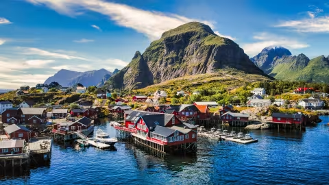
Å village
The fishing village of Å itself is small enough to walk in under an hour. Traditional red rorbuer line the waterfront, and the cluster here feels less commercialized than in Reine or Hamnøy.
There are two museums worth your time. The Norwegian Fishing Village Museum (Norsk Fiskeværsmuseum) is an open-air museum spread across several 19th-century buildings, covering roughly 200 years of life during the Lofoten fishing season. The boathouse with its collection of traditional Nordland boats is the highlight. The Lofoten Stockfish Museum, in a separate building nearby, covers the dried cod trade that sustained these communities for generations. It's small and specific, and the guided tours (summer only) are run by people who've spent years in the stockfish export business. Between the two, budget 60 to 90 minutes.
The bakery at Å has been operating since 1844, and the cinnamon buns come out of a stone oven from 1878. Get there early. They sell out.
Practical details
Å is free to visit, and free to park. The parking lot at the end of the E10 has a posted time limit, and overnight vehicle camping is not allowed. Parking enforcement across Lofoten has ramped up significantly, with 900 NOK fines. Check the signs when you arrive. Public toilets and a small shop are at the lot entrance. You can reach Å by car or by the local Lofoten bus service, which terminates here.
Plan for 30 to 60 minutes if you're just doing the viewpoint. Two to three hours if you add the village and museums.
Summer brings the best walking conditions and longest light but also peak crowds. Winter transforms the landscape with Northern Lights potential, but the rocky paths ice over. Micro-spikes are essential from December through March. Autumn and winter bring the highest winds, and standing near exposed cliff edges in a gale is genuinely dangerous.
Highlights
Best time to go
Time needed
Getting there
What to do nearby
Hotels nearby